Depends on how you are using it
Google Maps and Waze are two of the biggest navigation apps, and both are very similar – perhaps because they’re both owned by Google. But despite their similarities, there are some major differences between them that can help you decide which navigation app is better for you.
In this article, we’ll cover the main differences between Waze vs. Google Maps, as well as where each app excels. After reading this article, you’ll know exactly which navigation app suits your needs and driving style.
What Are Waze and Google Maps Available On?
Both Google Maps and Waze are available on Android and iOS. They are also both compatible with Apple CarPlay and Android Auto. So, regardless of your device or car, you’ll be able to use either app.
Google Maps and Waze are also both available via browser to plan routes and can send these routes directly to your phone.
How Do Waze and Google Maps Plan Your Route?
Google Maps and Waze are both reliable navigation apps and will easily get you to your destination. However, they do it in slightly different ways, and these nuances can change which routes you get. Whether you prefer one or the other largely depends on your driving style.
Google Maps has several options that can alter the route it gives you. By default, it will send you the quickest way and alter the route only if traffic is particularly bad or if hazards block the way. But, it is fairly customizable with settings that allow you to add conditions such as avoiding tolls and highways.
You can also set Google Maps to take you on the most fuel-efficient route. Using data from the National Renewable Energy Laboratory, Google Maps can calculate your fuel efficiency based on local averages and help you be a more carbon-friendly driver.
On the other hand, Waze appears to be much more concerned with ETA. Waze users note that it’s far more aggressive in avoiding traffic. Often, Waze sends you through side roads or “weird” routes to avoid time-consuming traffic, focusing on the ETA over everything else.
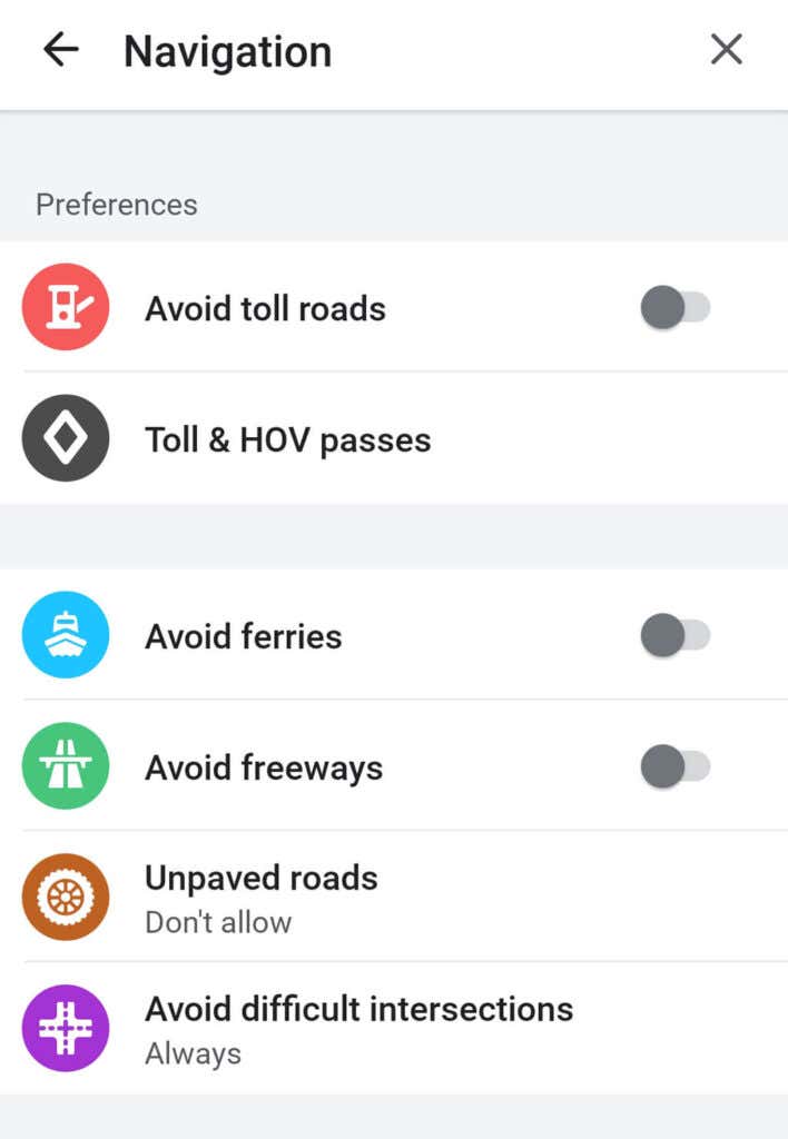
Perhaps because of this, Waze also features some customizable settings including asking it to avoid unpaved roads or difficult intersections. This can be very helpful depending on your location, as Waze is known to tell people to take very interesting routes.
Keep in mind, though, that if there’s no traffic or limited data, both apps are likely to send you on the exact route.
Waze Vs Google Maps: Versatility
If you’re driving by public transport, walking, or using a bicycle, Google Maps is your only option out of the two.
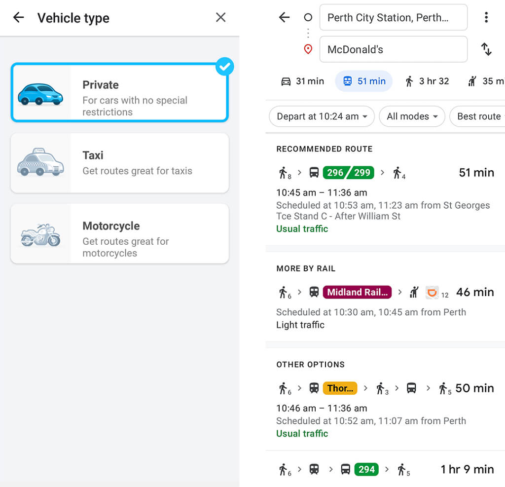
Google Maps has a complete repertoire of public transport timetables and maps for dozens of countries. It can also combine transport types seamlessly. If you need to catch the bus to work but there’s some walking involved between services – that’s no problem at all.
Even more impressively, Google Maps is able to include information about bike and e-scooter rentals and some ride-sharing services, depending on the location.
In contrast, Waze only offers support for three types of vehicles: private car, taxi, or motorcycle. So, when it comes to versatility, Google Maps is the clear winner.
App Design
Google Maps and Waze have quite different interfaces and designs. Their differences reflect their different purposes – Waze is designed to get you to your location as fast as possible in a car, whereas Google Maps is designed to do much more than that.
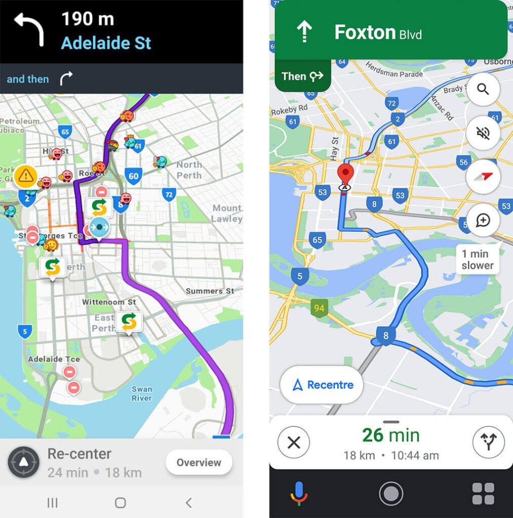
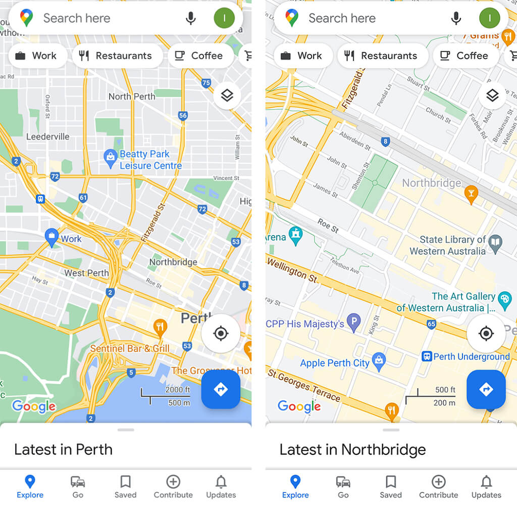
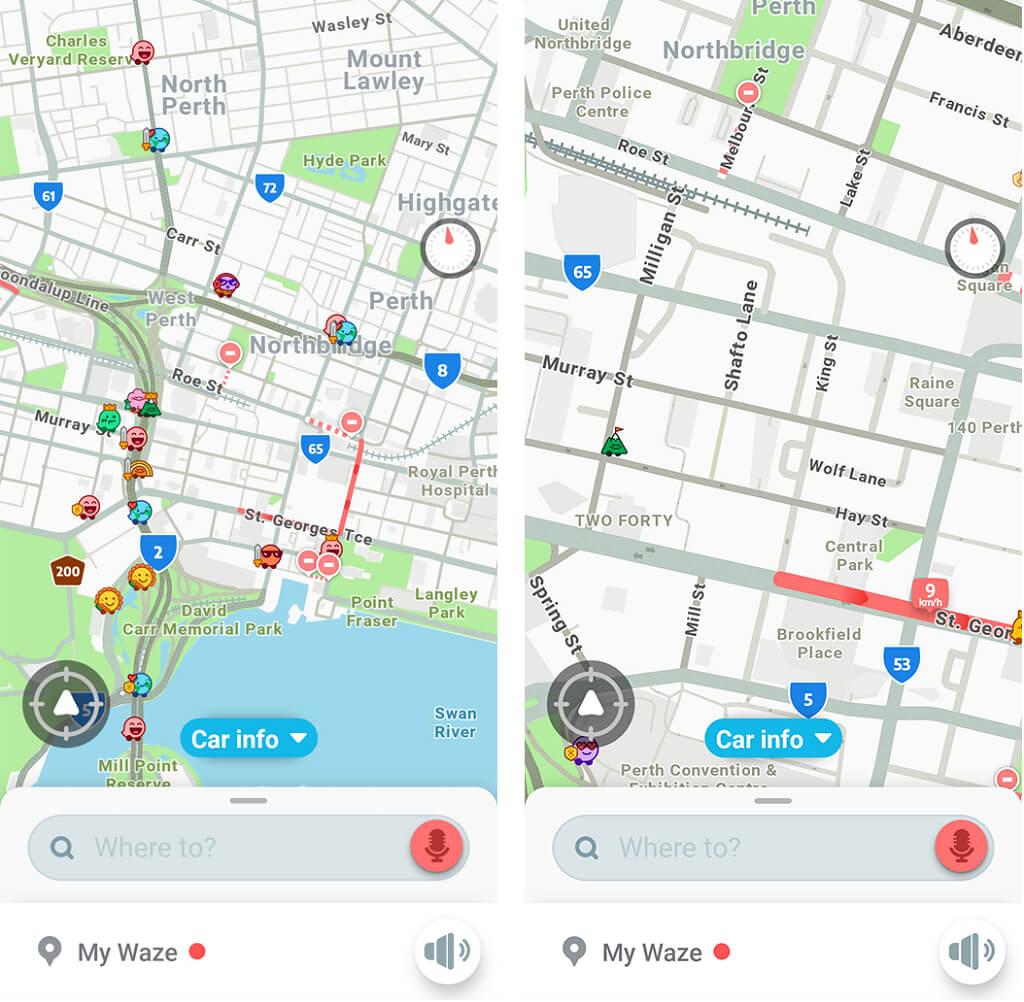
Google Maps has the look of a traditional GPS. It features a 2D simplified view, satellite view, or terrain view, and each can be customized to include various map details. In contrast, Waze is much more minimalist and slightly cartoonish.
Both apps display map data similarly. As you zoom in, more data is represented (like street names, location names, and smaller roads). Both apps also display a compass and can display a speedometer.
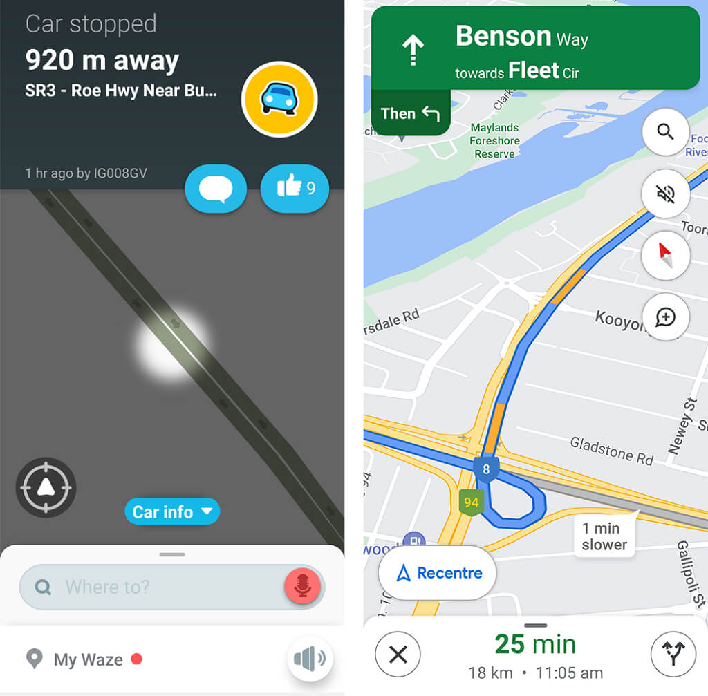
Further, both Google Maps and Waze are very similar while navigating. They both minimize the information on-screen and show your location, traffic data, speed limits, and road hazards. Interestingly, by default, Waze also displays other nearby Waze-users as little emoticons. This is a cute touch, but seems largely unnecessary.
Waze Vs Google Maps: Which Has Worse Advertising?
Google Maps and Waze display advertisements and paid content in-app. The difference is in how they display them.
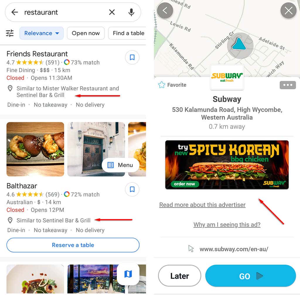
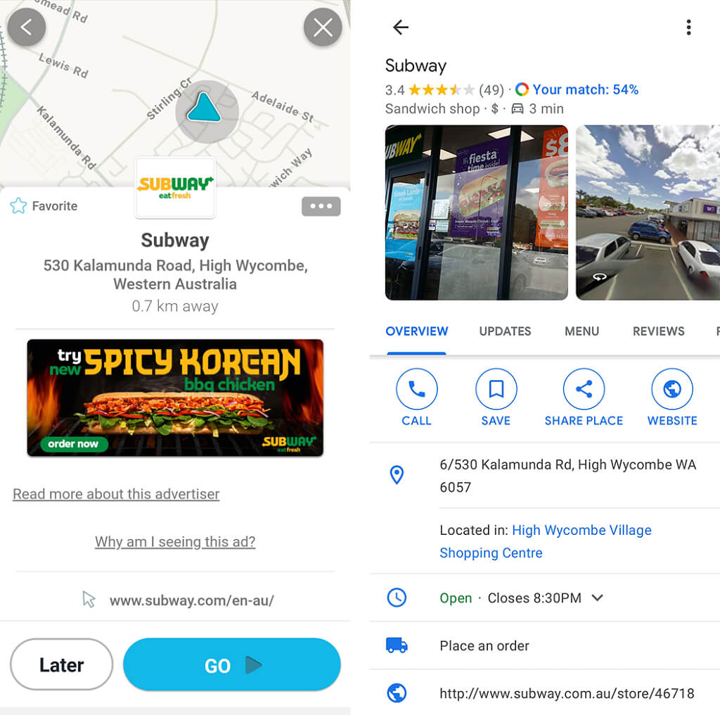
Google Maps displays a few nondescript banner ads, and these mostly appear when you search for or click on a location. It also features paid “Promoted Pins” (which display the company logo) and various other features for businesses to be more visible on the app, including customizable business pages.
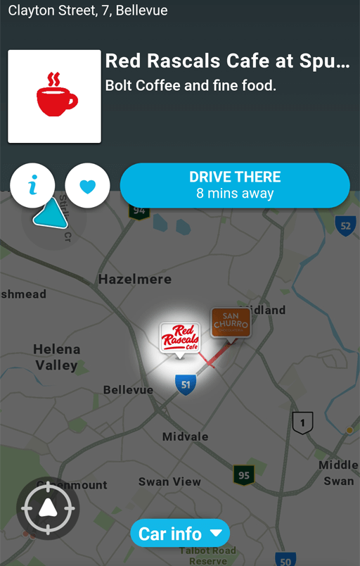
Waze advertisements are generally much more aggressive. They appear as large banners when you stop driving then disappear when you start moving again. These ads are location-based, meaning you’re likely to see content for nearby businesses.
Some users complain that Waze advertisements appear while driving and that they have to swipe them away to see their next turn, which is intruding and distracting to the driver. It’s important to note that this is a bug, and shouldn’t be the case for most users.
Is Google Maps or Waze Better At Finding Locations?
Both Google Maps and Waze are equally good at finding what you’re looking for using their search bar. Both will show the closest locations of a certain type, but Waze has fewer options and only shows the locations once you ask. Google Maps has all nearby locations constantly displayed and has far more categories to choose from, making it easier to find what you’re looking for.
Waze, with its much simpler design, often displays less information about locations and businesses near you than Google Maps. When you select a place – say your local McDonalds – Google Maps will provide you with information including opening hours, website, phone number, reviews, how busy it is, and more. In contrast, Waze often only shows a brief description of the business, a web address, or nothing at all.
Google Maps and Waze both feature offline GPS modes, though Google Maps has more functionality with this, allowing you to download entire areas to your phone.
Traffic and Road Hazards
Google Maps and Waze display traffic very similarly. Both show a red or yellow line depending on the level of traffic, and both offer alternative routes if the traffic is heavy (though Waze will do this much faster than Google). Both can display the same information, including roadworks, accidents, conditions, and speed cameras. Much of this information comes from user reports, especially for Waze.
When it comes to displaying the hazards and other road conditions, Waze seems to be the winner. Waze shows these hazards in very clear, easy-to-see icons. This is extremely helpful when planning a route (and avoiding speed cameras).
In summary:
- Both apps take into account traffic, hazards (including accidents), police traps, blocked roads, and weather conditions, but Waze displays these in a clearer way.
- Waze focuses more on ETA, while Google Maps provides the most all-around efficient route.
- Waze is for cars/motorcycles only, while Google Maps has modes for walking, cycling, and public transport, and can combine them into one route.
- Both Waze and Google Maps are excellent at finding locations, but Google Maps gives more information about them.
- Advertising is less intrusive on Google Maps than Waze.
- Google Maps provides much more information about locations and businesses.
So, Which Is Better: Waze or Google Maps?
No matter which of these two navigation apps you use, you’re going to get from A to B. The differences largely depend on preference.
If you want to get to your destination as quickly as possible and you only use a car or motorbike? Use Waze. If you want more location information, take public transport, and don’t mind a few extra minutes in traffic? Use Google Maps. If you don’t like either, check out some of the alternatives!
Which do you prefer? Let us know in the comments below.

