
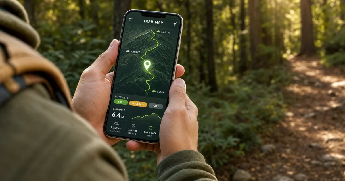
Heading out on the trail is one of the best ways to unplug, but a good hiking app is now just as essential as a sturdy pair of boots. Whether you’re trying to find a new trail near you, make sure you don’t get turned around in the backcountry, or just track how many miles you’ve covered this year, the right app makes all of it easier (and a lot less stressful).
The problem is there are a lot of hiking apps out there, and most roundups just throw a list at you without telling you what each one is actually good for. In this guide, we’ll walk you through the three best hiking apps in 2026, AllTrails, Gaia GPS, and Komoot, what each one does best, how to use the core features, and what you’ll need to pay for versus what you get free. We’ll also cover a few safety tips that most app guides skip entirely.

What to Look for in a Hiking App
Before we dive in, here’s what separates a genuinely useful hiking app from one that’ll let you down when you need it most:
- Offline maps: Cell signal disappears fast once you’re on the trail. Any app worth using should let you download maps to your phone before you leave home.
- GPS tracking: Your phone’s GPS works without cell service. A good app uses it to show your location on the trail in real time.
- Trail discovery: Filters for difficulty, length, elevation gain, and features like dog-friendly or kid-friendly routes save a lot of guesswork.
- Community info: Recent reviews and condition reports tell you things the trail description never will, like whether the creek crossing is flooded or the summit is snowed in.
- Route logging: Recording your hike gives you stats, a GPS track you can export, and a personal history of everywhere you’ve been.
With that in mind, here are the three apps we’d recommend in 2026.
AllTrails: Best for Finding Trails and Community Reviews

If you’re just getting into hiking or mostly do day hikes on established trails, AllTrails is almost certainly the first app you should download. It has one of the largest trail databases in the world, covering hiking, running, and biking routes, and the community reviews are genuinely useful for figuring out what a trail is actually like right now, not just what the park brochure says.
Available on Android, iOS, and the web, AllTrails works well for planning at home and navigating on the go.
Free vs. AllTrails+ (paid): The free version lets you browse trails, read reviews, and start basic navigation. To download offline maps, get wrong-turn alerts, and access advanced map layers, you’ll need AllTrails+, currently around $35.99/year. If you’re hiking anywhere without reliable cell service (which is most interesting trails), the paid tier is strongly worth it.
How to Find a Trail on AllTrails
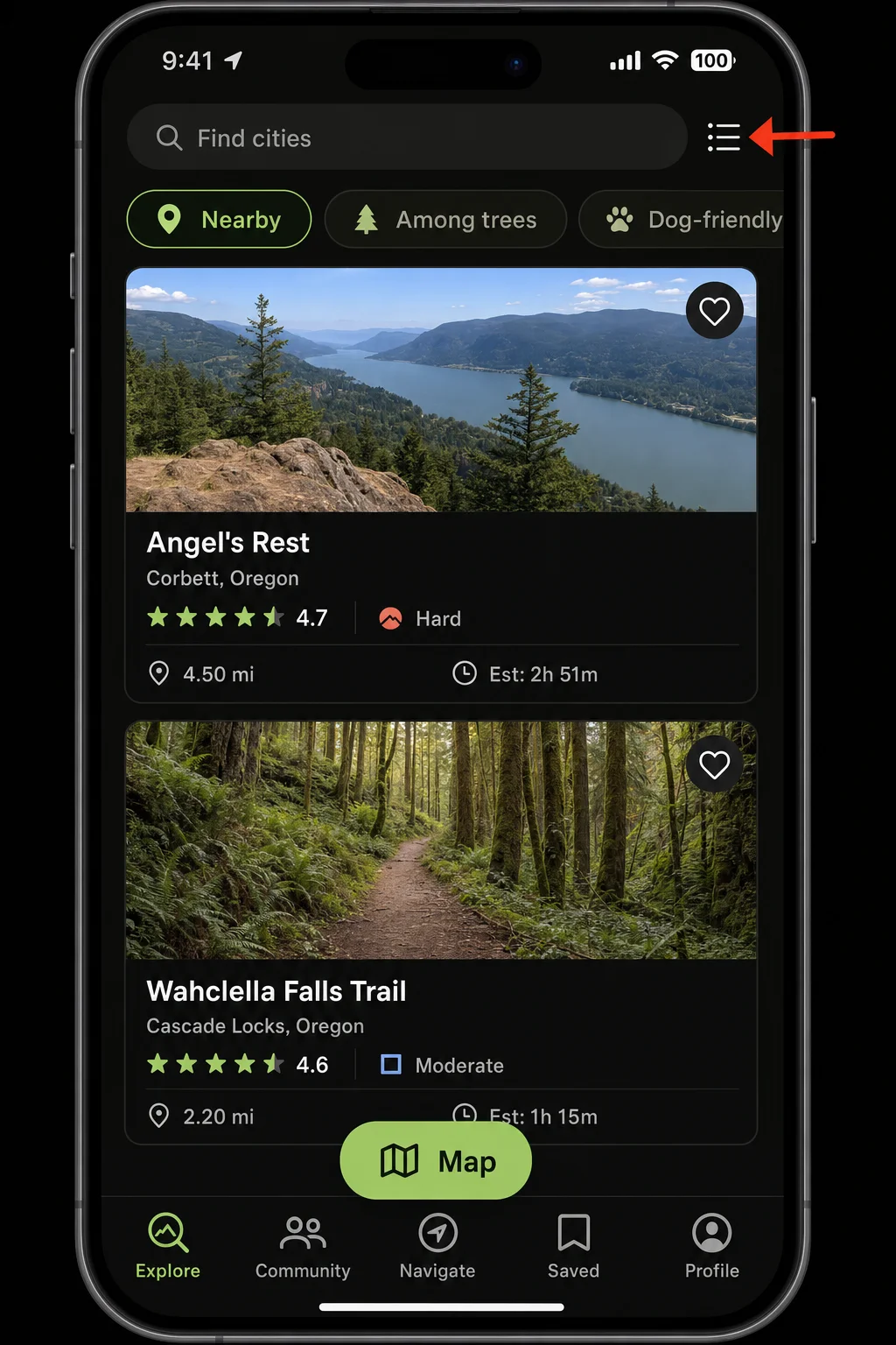
- Open the AllTrails app and tap the Explore tab at the bottom of the screen.
- Type a park name, city, or specific trail into the search bar, or tap Map to browse trails near your current location.
- Use the filter options to narrow results by difficulty, length, elevation gain, route type, and features like dog-friendly or wheelchair accessible.
- Tap any trail to open its detail page. Here you’ll find the trail description, stats, elevation profile, a map, and, most importantly, Recent Reports from other hikers with notes on current conditions.
How to Download a Trail for Offline Use (AllTrails+)
This is the step most people skip, and then regret when their map goes blank halfway up the mountain.
- Open the trail detail page for the hike you’re planning.
- Tap the Download button (it looks like a downward arrow). You’ll need an AllTrails+ subscription to do this.
- Confirm the download area on the map view. You can adjust the bounding box to make sure you’re capturing the full trail area.
- Wait for the download to complete. Do this at home on Wi-Fi, not in the parking lot before your hike.
- Before you leave: Switch your phone to airplane mode and open the map to confirm it loads correctly. If it goes blank, the download didn’t work and you need to try again.
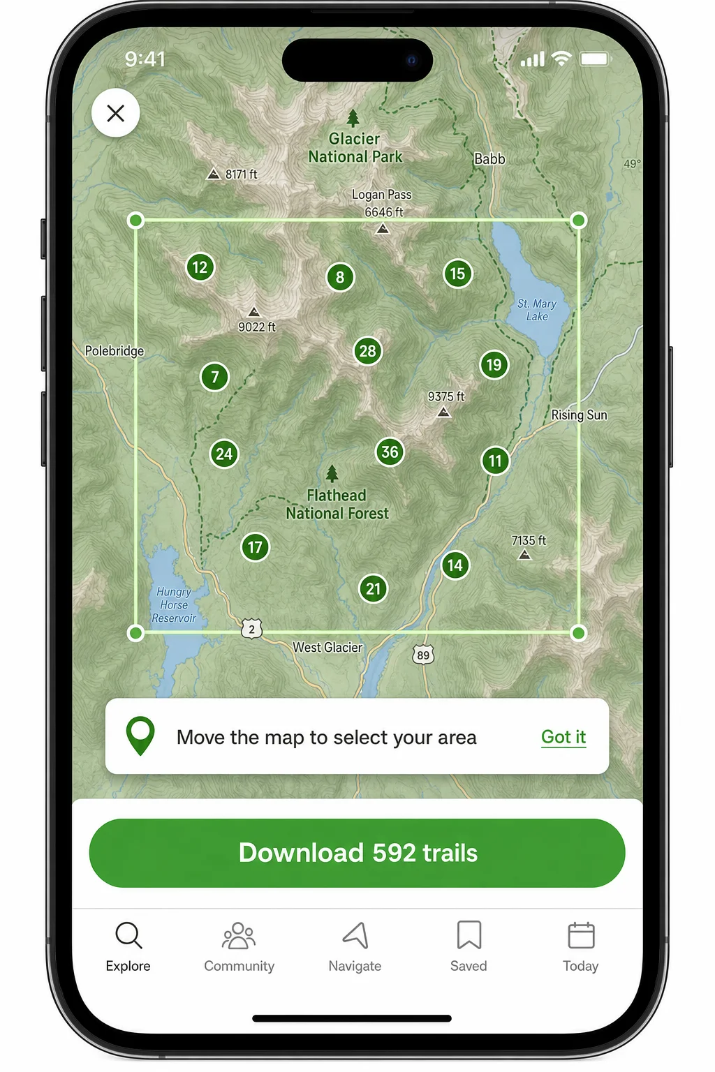
You can also download additional map layers, including USGS Topo, Satellite, Terrain, and World Parks, from the map layers menu on your downloaded trail. Just keep in mind each layer takes up storage space on your phone, so only grab what you actually need.
How to Navigate and Record a Hike on AllTrails
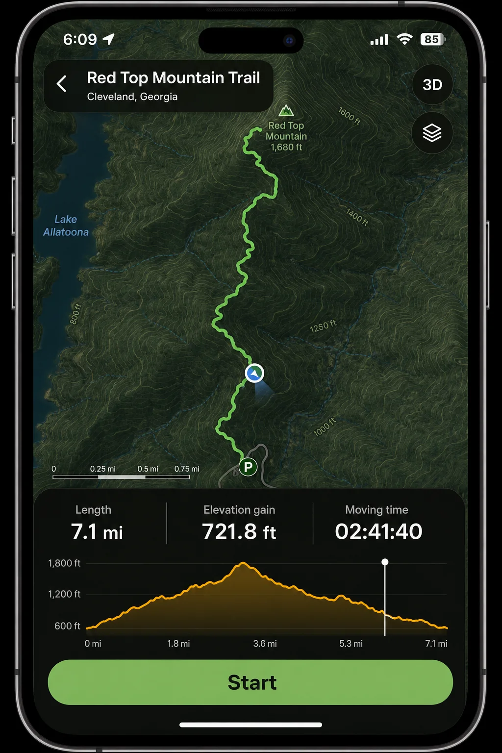
- On the trail detail page, tap Navigate (or Start) to begin.
- AllTrails will show your live position on the trail map, your route line, distance covered, and elevation stats as you walk.
- If you have AllTrails+, the app will send a wrong-turn alert if you stray off the route, which is handy when the trail markings get confusing.
- When you’re done, tap Finish to stop recording. Give your activity a name, add any photos or notes, and save it.
- Your saved hikes live under your Profile tab. From there (or from the web), you can export a GPX file of your route if you want to keep a backup or share it with someone else.
Gaia GPS: Best for Backcountry Navigation and Serious Map Nerds
If AllTrails is the app for finding popular trails, Gaia GPS is the one you want when you’re heading somewhere more serious. Think off-trail routes, remote wilderness areas, or any situation where you really, truly cannot afford to get lost.
Gaia GPS gives you access to a huge range of map layers, including USGS Topo, satellite imagery, public and private land boundaries, slope angle shading for avalanche awareness, and more. It’s available on iOS and Android, with a web planner at gaiagps.com for desktop route planning that syncs to your phone.
Free vs. Gaia GPS Premium: The free version gives you basic GPS tracking and some map layers. The best layers, including USGS Topo, satellite, and land ownership overlays, are behind the Gaia GPS Premium subscription (around $39.99/year). For backcountry use, Premium is basically required.
How to Plan a Route on Gaia GPS
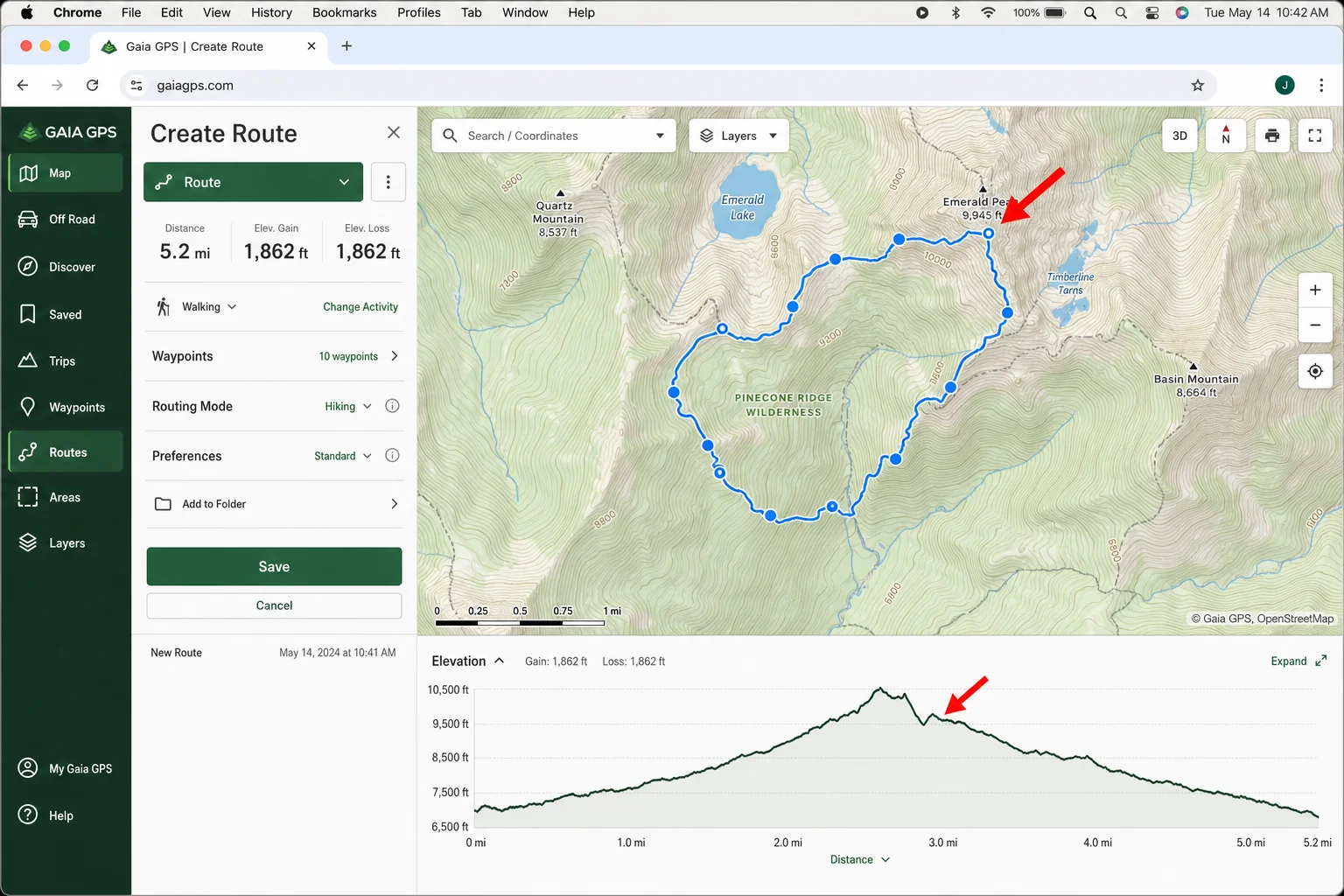
- Head to gaiagps.com on your desktop browser and log into your account. The web planner is much easier to use for route building than the phone app.
- Click along the map to drop waypoints and build your route. Gaia will calculate the distance and elevation profile as you go.
- Save the route to your account and it’ll sync automatically to the Gaia GPS app on your phone.
How to Download Offline Maps on Gaia GPS
- In the mobile app, navigate to the area you want to download.
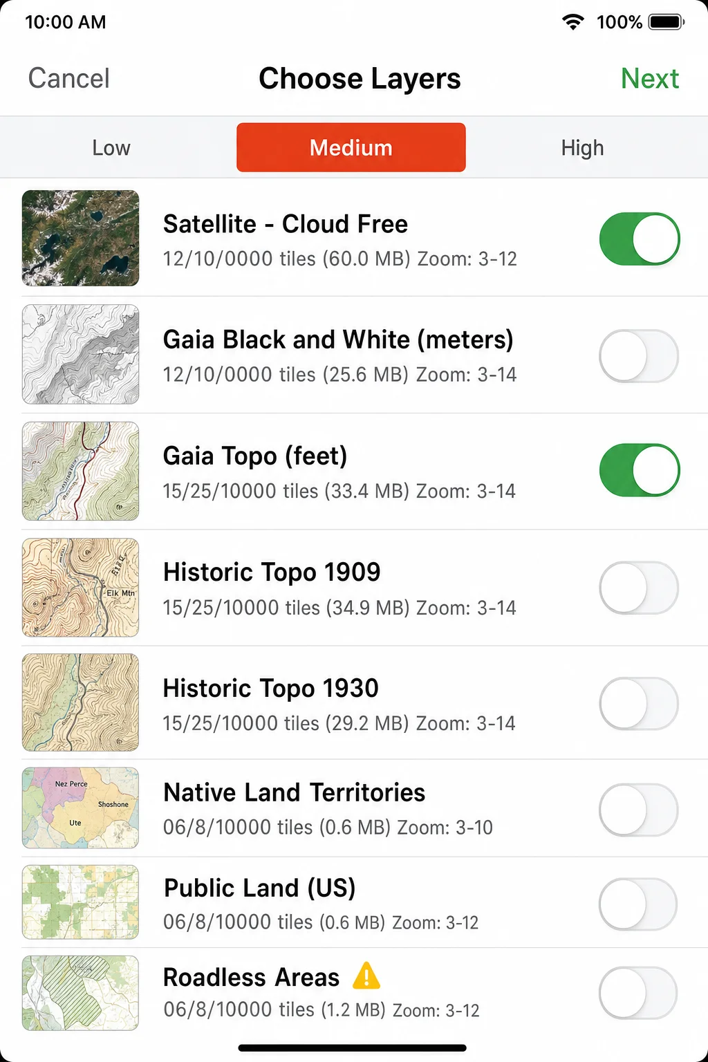
- Tap the Download icon (or go to Settings > Offline Maps).
- Select the map layers you want to download. At minimum, grab USGS Topo for the terrain and Satellite if you want visual reference.
- Choose your download area and zoom levels, then tap Download.
- As with AllTrails, test in airplane mode before your trip to make sure everything loaded correctly.
How to Record a Track on Gaia GPS
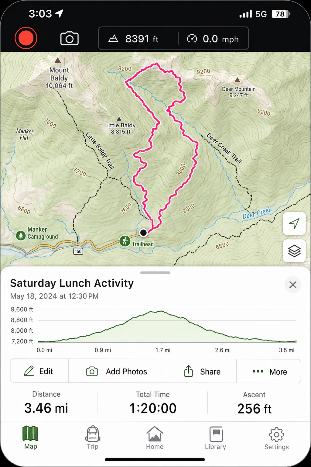
- Open the app and tap the Record button to start tracking your position.
- Gaia will lay down a continuous GPS breadcrumb trail showing exactly where you’ve been, which is useful for retracing your steps if needed.
- When you’re done, tap Stop to end the recording. Name your track and save it.
- View full stats, elevation data, and your route map under your saved tracks. You can export as a GPX file from the track detail screen.
Komoot: Best for Route Planning and Turn-by-Turn Navigation
Komoot is probably the most underrated app on this list, especially if you’re in Europe, where it’s arguably the most popular hiking and cycling navigation app around. But it’s worth using anywhere, because its route planning tools and turn-by-turn navigation are genuinely excellent.
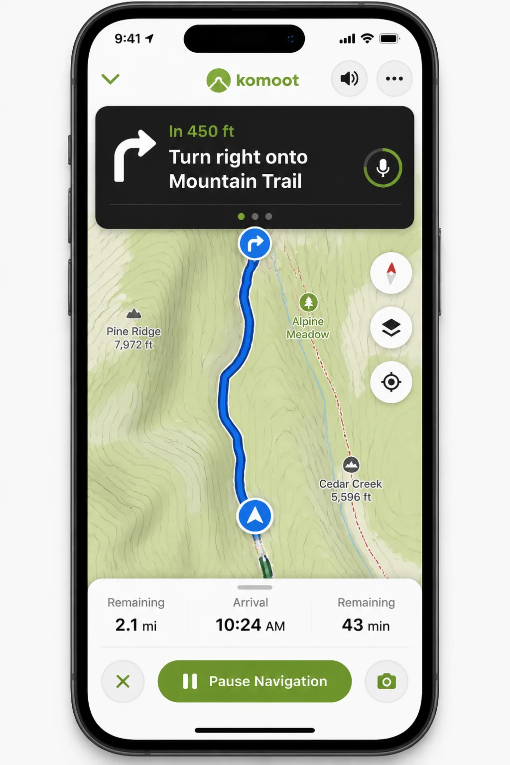
Available on iOS, Android, and the web, Komoot lets you plan a route from A to B (with waypoints), auto-routes along actual trails and paths, and then guides you with voice-prompted turn-by-turn navigation on your phone. That’s a feature AllTrails doesn’t do as well.
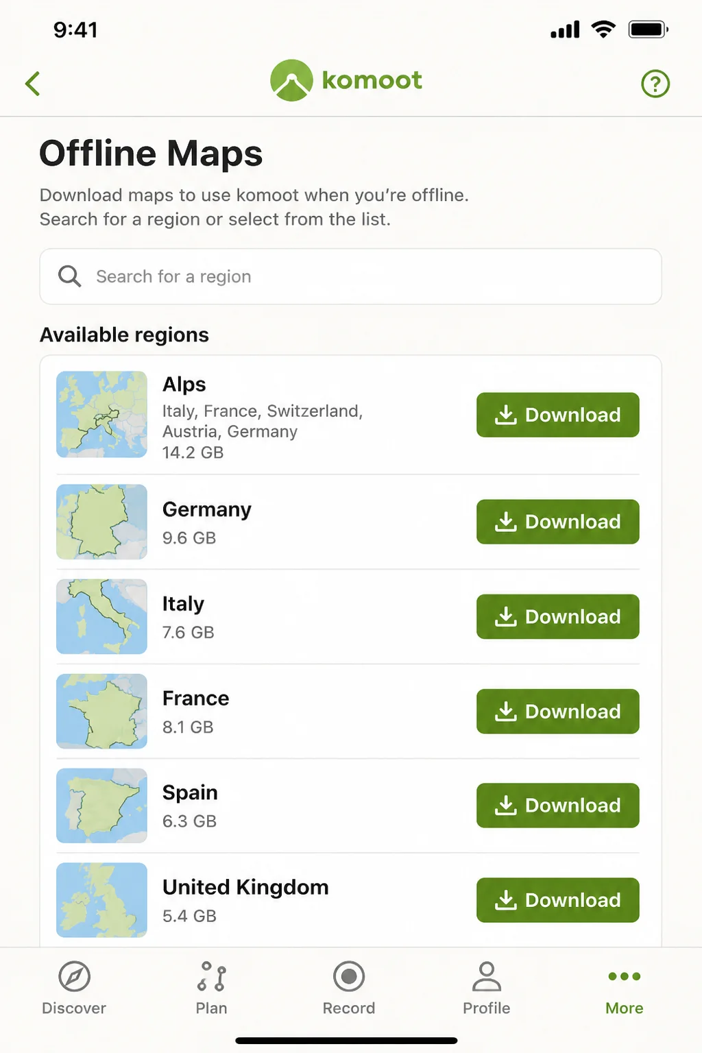
Free vs. Komoot Premium: Komoot offers a free tier with one region included. Additional regions are available as one-time purchases, or you can get Komoot Premium (around $59.99/year) for unlimited offline maps, multi-day trip planning tools, and curated route collections. If you hike in multiple areas, Premium is the better deal.
How to Plan and Navigate a Route on Komoot
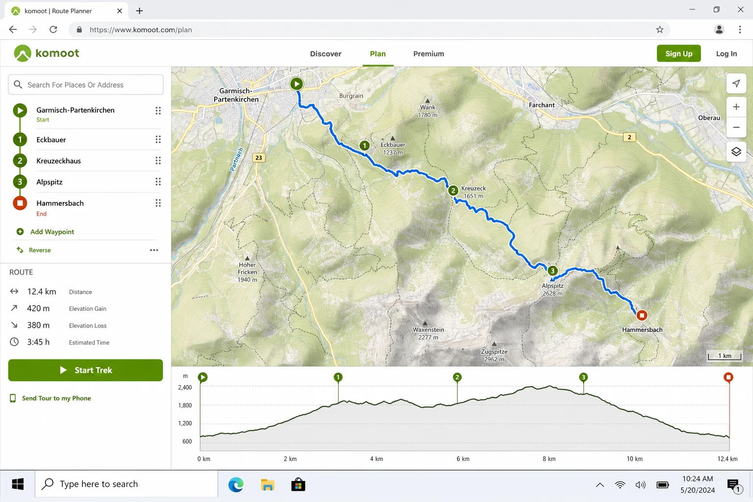
- Open the Komoot app or head to komoot.com and tap Plan a Tour.
- Set your start point and destination. Add waypoints if you want to hit specific spots along the way.
- Select your sport type, Hiking, Mountain Biking, Road Cycling, etc. Komoot uses this to auto-route you along appropriate paths and surfaces.
- Review the suggested route, distance, elevation profile, and estimated time. Adjust waypoints if needed.
- Save the tour to your account. It syncs to the app on your phone.
How to Download a Region for Offline Use on Komoot
- In the Komoot app, go to your profile and tap Offline Maps.
- Find the region you need and tap Download. If you haven’t unlocked that region yet, you’ll be prompted to purchase it or use a Premium credit.
- Once downloaded, your planned routes in that region will be fully available without cell service.
How to Navigate and Record with Komoot
- Open your saved tour in the app and tap Start Navigation.
- Komoot provides voice-guided turn-by-turn directions as you walk. It’ll tell you when to turn and alert you if you go off route.
- Your route is recorded automatically while you navigate. When you finish, tap Finish Tour.
- Save your completed tour with photos, highlights, and a difficulty rating. It appears in your profile under Completed Tours with full stats.
Other Apps Worth Knowing About
AllTrails, Gaia GPS, and Komoot cover most hikers’ needs, but depending on what kind of hiking you do, these alternatives are worth a look:
- FarOut (formerly Guthook): The go-to app for US long-distance thru-hikers on the AT, PCT, CDT, and other major trails. It has trail-specific guides with water sources, campsites, and hiker comments that are incredibly detailed.
- Outdooractive / OS Maps: Strong picks for hikers in Europe and the UK, with official topographic maps and rights-of-way data that general apps sometimes miss.
- Mapy.cz: Frequently recommended as the best free offline hiking app, especially in Europe. Great as a backup navigation source when you don’t want to pay for multiple subscriptions.
- Avenza Maps: Useful if you want to use specific PDF maps offline, like official park-issued trail maps or specialized topo sheets that other apps don’t carry.
Tips and Troubleshooting
Before You Head Out
- Always test offline maps in airplane mode: Download your maps at home, then switch to airplane mode and open the app to verify everything actually loads. A lot of hikers assume the download worked and then find a blank screen on the trail.
- Download the whole region, not just the trail line: If you end up off-route or need to take a different path back, a narrow trail download won’t help. Grab the full surrounding area.
- Charge your phone fully and bring a power bank: GPS plus screen-on navigation drains batteries fast. On longer hikes, a small external battery pack is worth the weight.
- Use two apps as backup: Even experienced hikers carry a second navigation source. A common combo is AllTrails+ for primary navigation and Mapy.cz or a downloaded Gaia GPS map as a backup.
Common Issues
Problem: The map shows my location but the trail line has disappeared
This usually means the offline download didn’t complete or wasn’t saved correctly. Go back to the trail detail page while you still have Wi-Fi or cell service, delete the existing download, and re-download it. Then test in airplane mode before your trip.
Problem: GPS position is jumping around or showing me in the wrong place
Give your phone a minute to lock onto GPS satellites after you open the app, especially if you’ve just arrived in a new area. Standing in a clearing away from dense tree cover helps. If it keeps misbehaving, try closing and reopening the app.
Problem: Not sure whether to pay for AllTrails+, Gaia Premium, or Komoot Premium
Here’s a simple way to think about it: if you mostly do popular day hikes on established trails, AllTrails+ is probably all you need. If you’re doing off-trail or backcountry routes where navigation is genuinely critical, add Gaia GPS Premium. Komoot Premium makes the most sense if you hike in multiple regions across Europe or do a lot of multi-day route planning.
A Word on App Safety
This is worth saying clearly: a hiking app is not a substitute for basic navigation skills. Apps crash, phones die, and GPS signals can be unreliable in deep canyons or under heavy tree cover. For any serious backcountry trip, it’s worth knowing how to read a paper map and use a compass, and carrying both as backup. For remote areas where you could be out of cell range for days, a satellite communicator (like a Garmin inReach) is the kind of safety net that can genuinely save your life.
Wrapping Up
Hiking apps have come a long way. They’re genuinely useful gear now, not just a nice-to-have. For most hikers, AllTrails is the best place to start: it’s great for finding trails and reading up-to-date conditions before you go. If you’re pushing into more serious terrain, Gaia GPS gives you the map depth and offline reliability you need. And if you want proper turn-by-turn navigation or do a lot of route planning, Komoot is hard to beat. Use at least two of these together, download your maps before you leave home, and you’ll be in pretty good shape out there.
Just remember to bring a backup and tell someone where you’re going, no app replaces that.